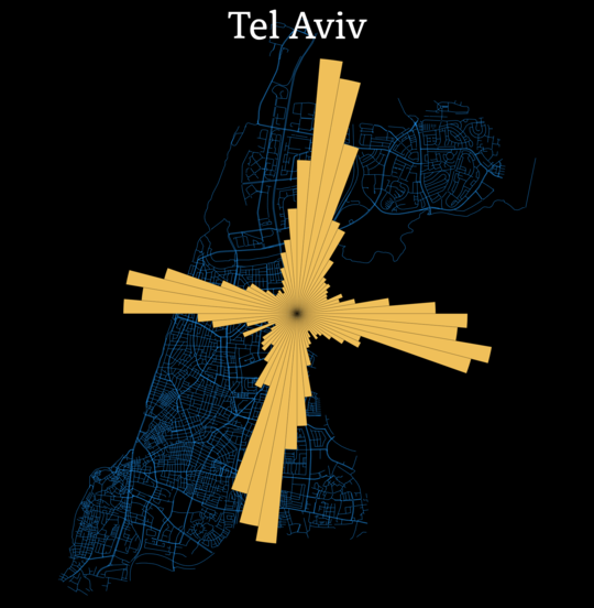
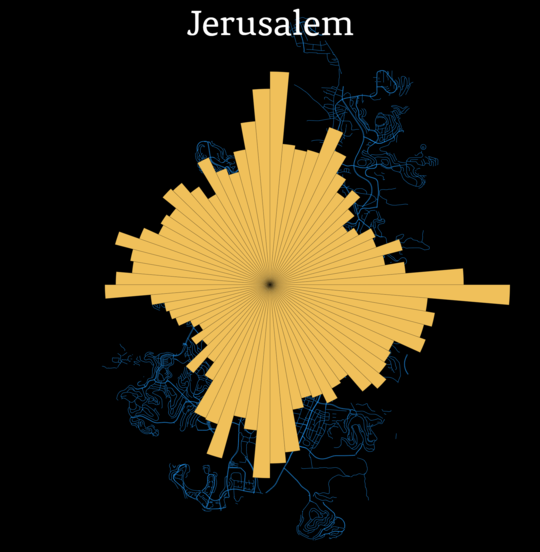
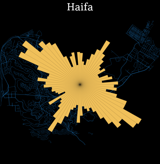
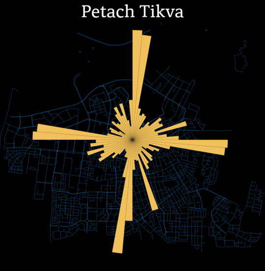
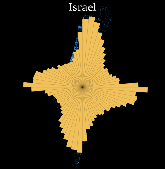
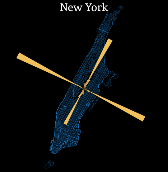
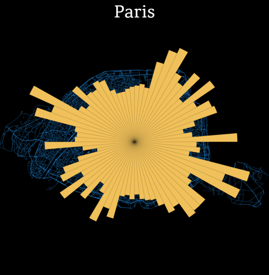
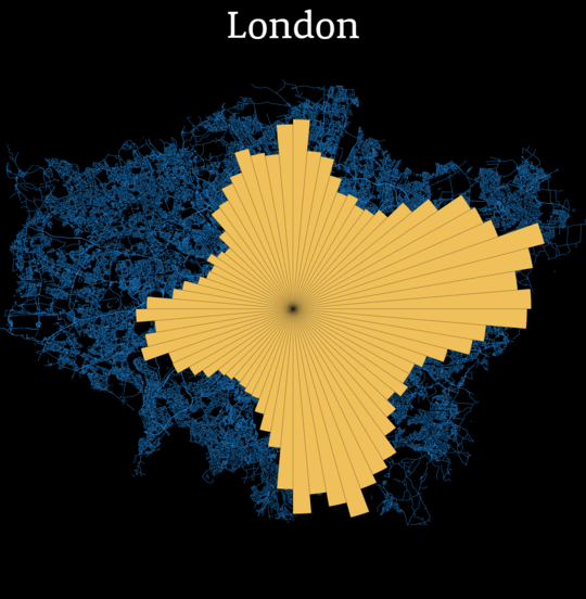
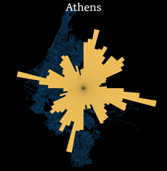
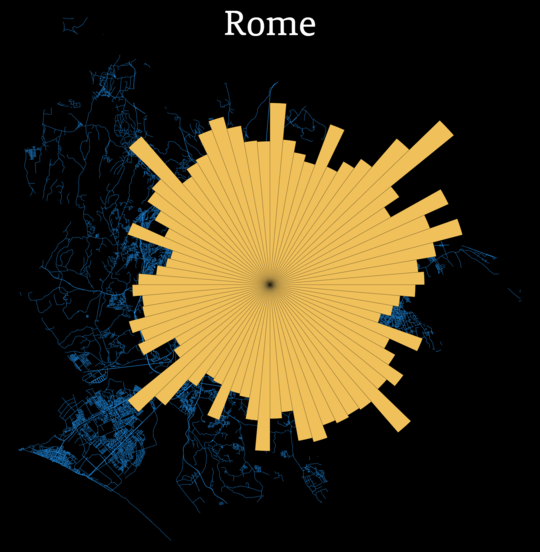
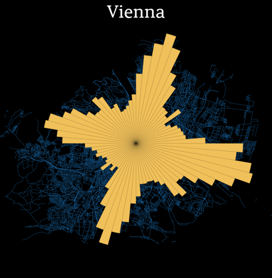
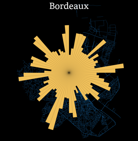
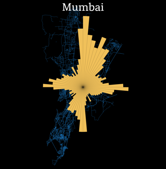
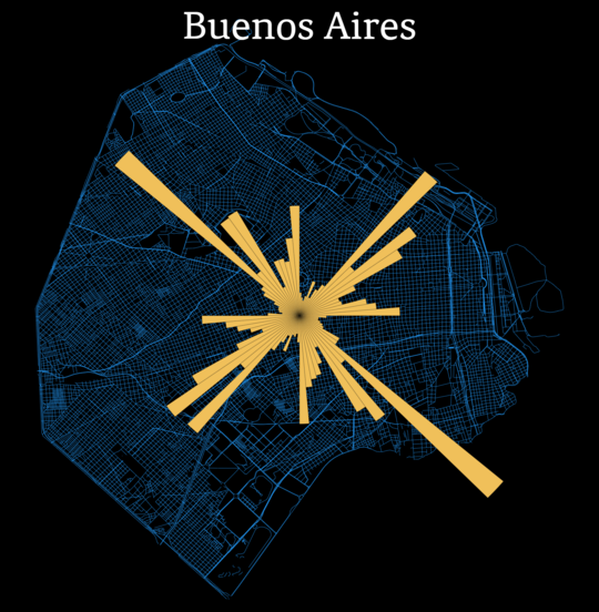
Here's how the paths' orientations are distributed:
There are 72 bins, so each bin corresponds to a five degree angle.
Here's how I did it:
- Geofabrik hosts dumps of pbf files arranged by country or region.
- Nominatim gives the relation ID of a city.
- polygons.openstreetmap.fr gets the city's boundaries.
- Osmium slices the pbf file according to the city boundaries and filters just w/highway.
- Mercator projection converts from lon/lat to x/y. I used this projection because it is angle preserving.
- d3js gives the animation. To get a video I slowed it down and used a Python script that fires Selenium to capture the screen every second or so. Feel free to look at the source code here.
Here are some other cities. Click for full size.
